WHAT WE OFFER
Monitor land from space. Make better decisions on the ground
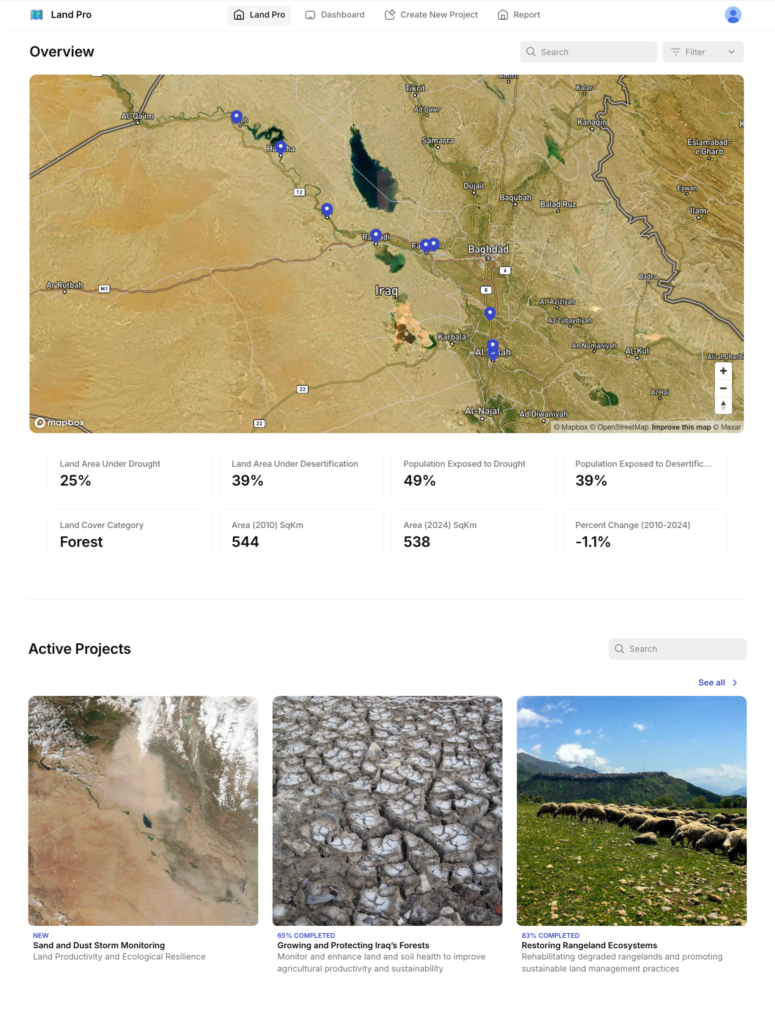
Change Detection & Classification
Automated detection and mapping of land use/land cover changes with alerts, transition analysis, and compliance reporting.
Time Series Analysis & Forecasting
Multi-temporal trend analysis, seasonal pattern detection, and predictive modeling to understand how land cover is changing over time for proactive planning.
Custom Intelligence
Land cover mapping, analysis, and reporting tailored for specific monitoring needs and regulatory requirements—from baseline studies to compliance verification
HOW IT WORKS
From satellites to decisions
We monitor
Track your areas of interest using satellite imagery, automatically detecting changes as they occur.
We analyze
Classify land cover, detect changes, and identify trends using machine learning models.
You decide
Receive reports, maps, and alerts formatted for your workflow that you can use immediately.
Why us
Precision Geospatial Insights Tailored for Regional Needs
Locally Adapted: Our models are trained on regional land types, crop calendars, and desert dynamics—not generic global patterns. We understand local crop varieties, how regional soil respond to stress, and the seasonal patterns that matter in your area.
Policy-Aligned: Built to match national classification systems and compliance requirements. Our outputs speak the language of your regulatory framework, making reporting and planning seamless.
Action-Oriented: Clear insights that support planning, monitoring, and reporting—not just maps. We deliver answers you can use immediately, formatted for decision-makers and analysts alike.